Page Not Found
Page not found. Your pixels are in another canvas.

A list of all the posts and pages found on the site. For you robots out there is an XML version available for digesting as well.
Page not found. Your pixels are in another canvas.
About me
This is a page not in th emain menu
Published:
Inspiration: can a visually appealling ecosystem model also be informative??
Illustration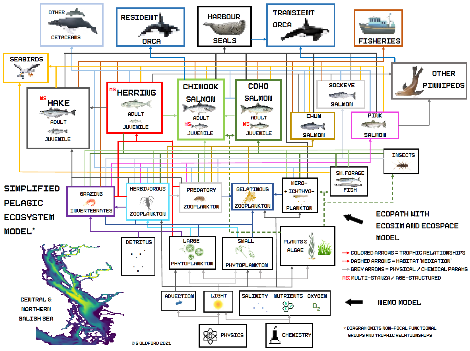
A hanging, electronically controlled installation with lights sequentially lit using a real, ecological food web model associated with Atlantic Cod.
Stainless steel, quartz, fibre optics, electronics.
Part of the CFAT New Media Arts Scholarship and displayed at Halifax’s Nocturne Art-at-Night Festival.
Some recent motifs and concepts I’ve been playing with.
Spray paint on wood panels
Marine ecosystem models to investigate changes in salmon survival and to support marine spatial planning
We are collaboratively developing a pre-European contact shoreline to assist the Tsleil Waututh First Nation with reconstructing the location of the shoreline, analysis of intertidal habitat changes, and ecosystem modeling. 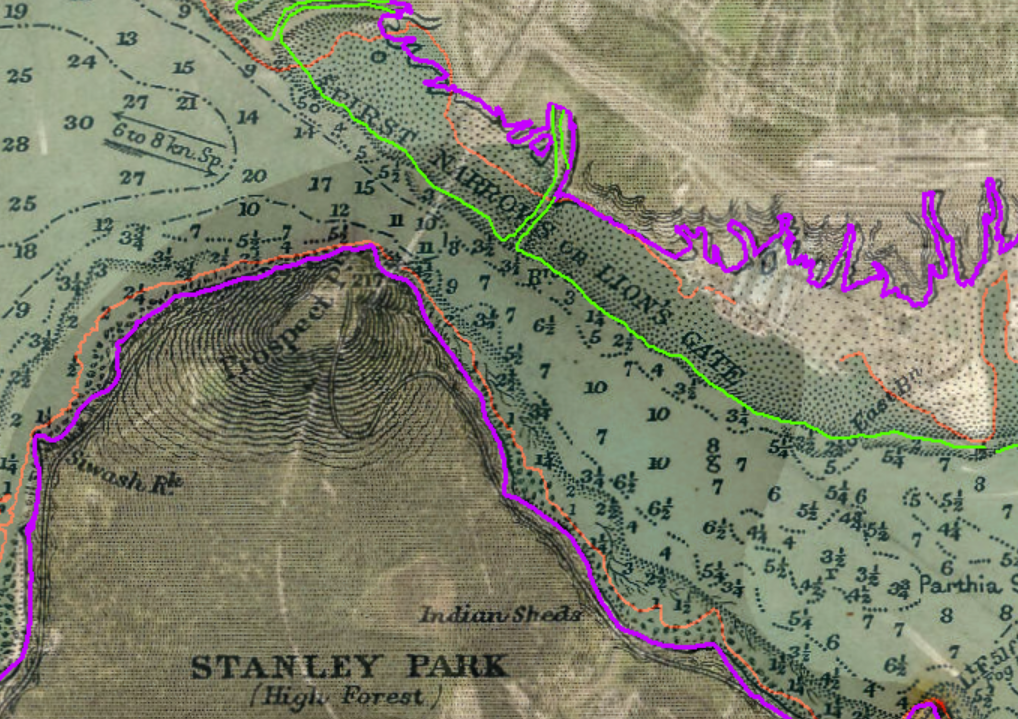
Marine Spatial Planning has many moving parts. As part of a team of grad students I helped produce an online ‘story map’ giving an interactive overview of technical aspects for the Tsleil Waututh First Nation. 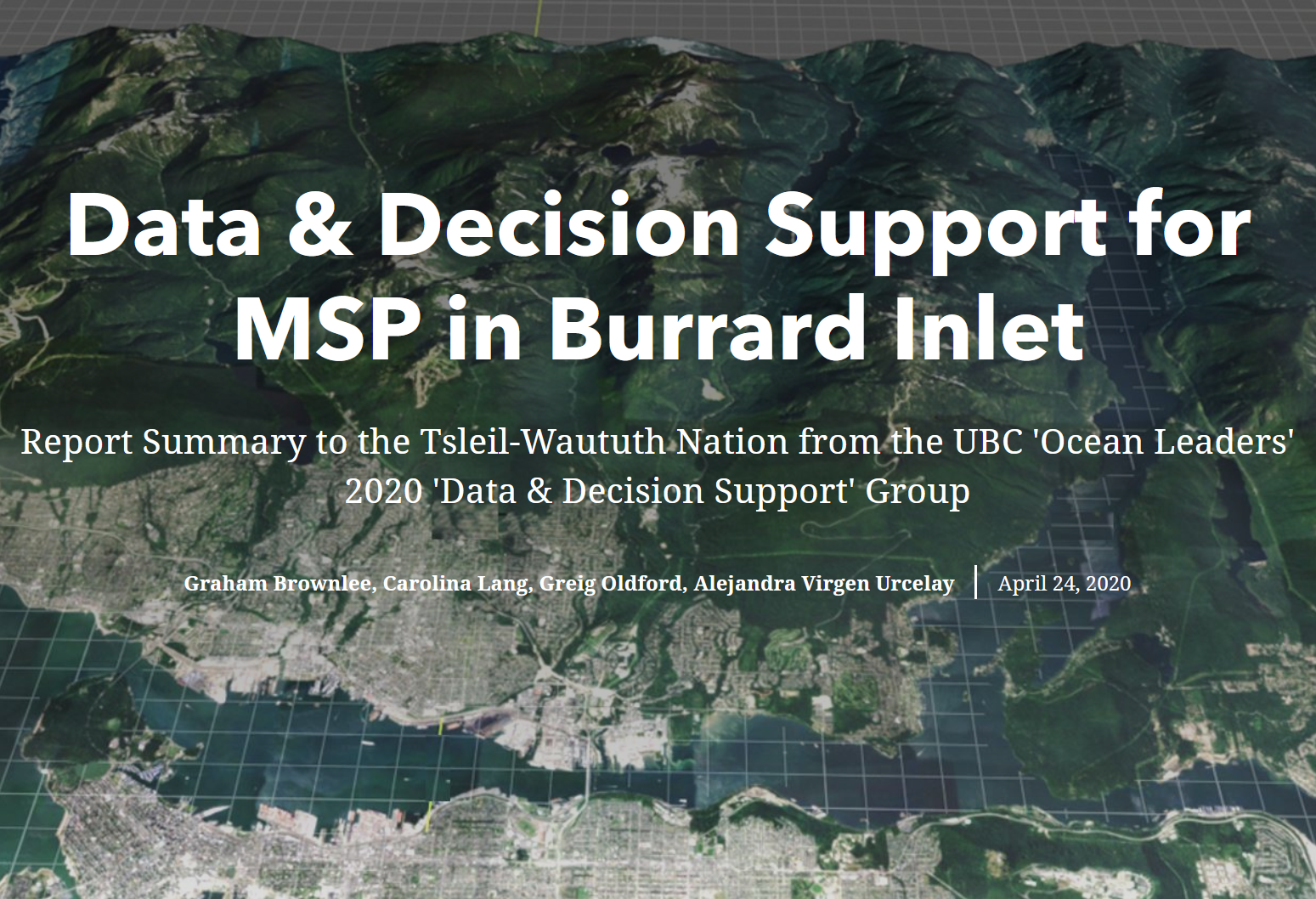
Leading the development of the FIPEX tool with the DCI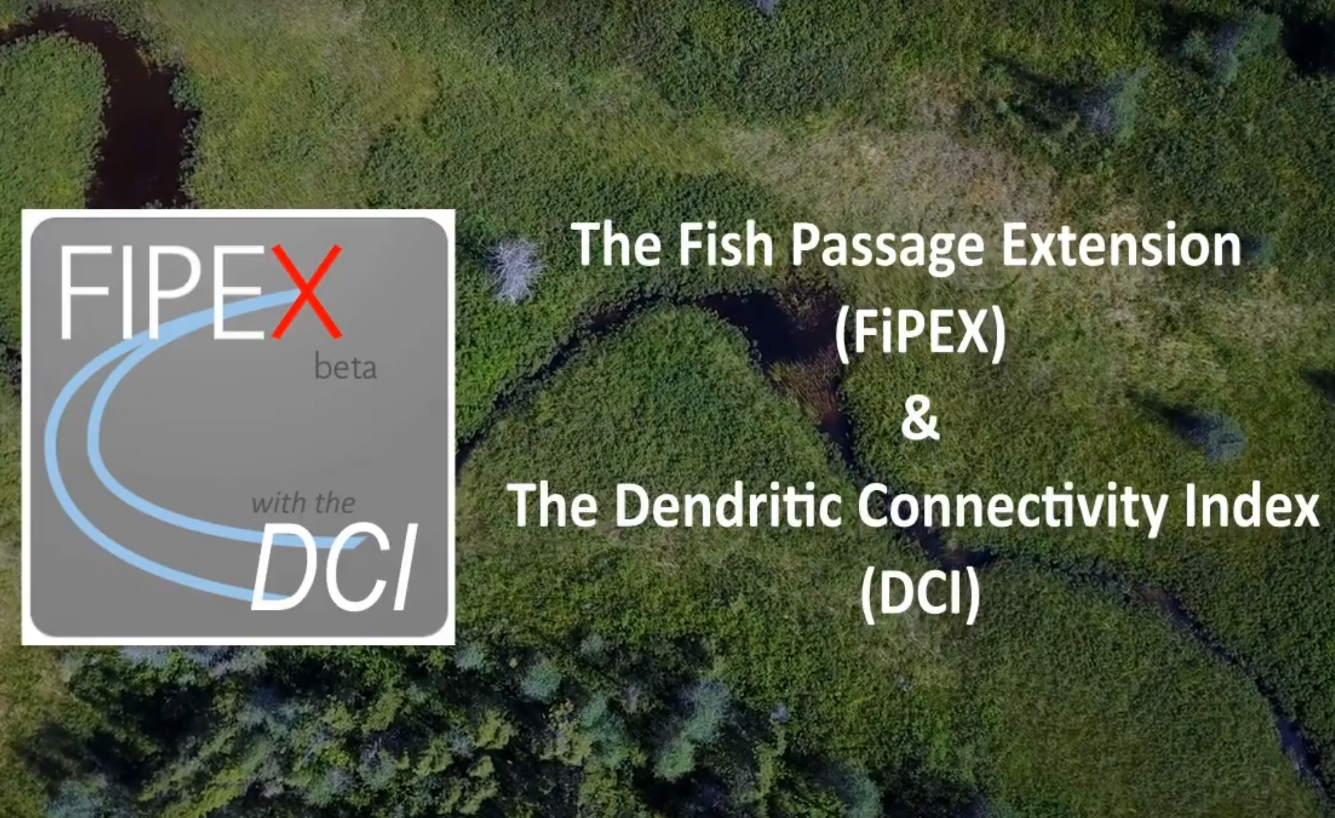
Working collaboratively to establish a network of Marine Protected Areas in British Columbia, Canada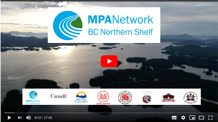
Oldford G (2013). "Spatial Optimisation of River Restoration Planning in Nova Scotia, Canada [Thesis]" School for Resource & Environmental Studies. (https://dalspace.library.dal.ca/bitstream/handle/10222/36309/Oldford-Greig-MES-SRES-August-2013.pdf?sequence=1)
River restoration is believed to have the greatest chance of success when action is considered in the broader context of the riverscape. However, methods are lacking to fully integrate systemic connectivity into decision-making.
Published in Dalhousie University, Halifax, Nova Scotia, 2013
McKay SK, Cooper AR, Diebel MW, Elkins D, Oldford G, Roghair C, Wieferich D. (2016). "Informing Watershed Connectivity Barrier Prioritization Decisions: A Synthesis.." River Research and Applications. 33(6). (http://goldford.github.io/files/oldford_001.pdf)
This paper synthesizes 46 watershed-scale barrier planning studies and presents a procedure to guide barrier prioritization associated with connectivity for aquatic organisms.
Published in River Research and Applications, 2016
Martone R.G., G. Oldford , C. McDougall, J. Cristiani, A. Chow, C. Robb, E. Rubidge, K.S.P. Gale, L. Chaves, E. Damjkar, P. Mahaux, S. Ban. (2018). "Assessing Contribution of Established Protected Areas Towards Meeting MPA Network Objectives in the Northern Shelf Bioregion[in Chandler, P.C., S.A. King, J. Boldt (2018). State of the Physical, Biological and Selected Fishery Resources of Pacific Canadian Marine Ecosystems in 2017. Canadian Technical Report of Fisheries and Aquatic Sciences. No. 3266]" Canadian Technical Report of Fisheries and Aquatic Sciences. 3266 https://goldford.github.io/files/2017_SOPO.pdf
We present an approach for determining how effectively the existing MPAs meet the ecological conservation priority targets in Canada’s Northern Shelf Bioregion, taking potential cumulative impacts from human activities into consideration
Published in Canadian Technical Report of Fisheries and Aquatic Sciences, 2018
Oldford GL, Duinker P.N., Gunn E.A., Kehler D.G. (TBD). "Dams, Culverts, and Cumulative Effects: Quantifying Cumulative Effects of Barriers to Longitudinal Connectivity on Three Rivers in Nova Scotia, Canada." River Research & Applications. (in revision) TBD
(underway - accepted with minor revisions)
We present a suite of approaches that can be used to quantify and characterize the cumulative effects of different types of riverine barriers. We demonstrate these methods on three river systems in Nova Scotia, Canada, each heavily fragmented by road culverts and dams associated with hydroelectric and other development.
Published in River Research and Applications, 2018
Brownlee G, Lang C, Oldford G, Virgen-Urceley, A (2020). "Technical aspects of Marine Spatial Planning in Burrard Inlet" Tech Report. Tsleil Waututh First Nation
we prepared this report for the TWN by reviewing and synthesizing academic and other available literature from around the world. We focused on three critical aspects of MSP: (1) Data Needs and Management, (2) DSTs and Models, and (3) Outreach and Communication.
Published in TWN, 2020
Oldford, G. (2020). "It’s time to call out denialism — on racism and on climate change." The National Observer. June 4, 2020. https://www.nationalobserver.com/2020/06/04/opinion/its-time-call-out-denialism-racism-and-climate-change
Everyone is entitled to their opinion. But newspapers — especially mass media outlets — should be held accountable when they propagandize dangerous denialism instead of presenting facts
Published in The National Observer, 2020
Oldford G, Christensen VC, Buszowski J, Steenbeek J, Hunt B, Pearsall I, Walters CW (in prep). "End-to-End Spatial Ecosystem Modeling in Support of the Salish Sea Marine Survival Program " dissertation. (in prep)
My PhD dissertation involves (1) acquiring and prepping a large amount of ecological and human activities data, (2) co-developing a hydrodynamic-biogeochemical model, (3) development of a spatial-temporal ecosystem model, (4) and application of the model complex to investigate declining trends in marine survival of coho and Chinook salmon in the Salish Sea.
Published in PhD Research, 2021
Steenbeek J, Buszowski J, Chagaris D, Christensen V, Coll M, Fulton EA, Katsanevakis S, Lewis KA, Mazaris AD, Macias D, de Mutsert K, Oldford G, Pennino MG, Piroddi C, Romagnoni G, Serpetti N, Shin YJ, Spence MA, Stelzenmuller V. "Making spatial-temporal marine ecosystem modelling better - a perspective " Environmental Modelling and Software. Vol 145, November 2021 https://doi.org/10.1016/j.envsoft.2021.105209
Marine Ecosystem Models (MEMs) are rarely systematically validated and calibrated. This can potentially undermine the credibility and uptake of model output in the policy arenas where it is so direly needed. We identify the main technical hurdles that prevent the MEM community from moving forward, and specify a resolving framewo
Published in Environmental Modelling and Software, 2021
Taft, S., Oldford, G. , M.I., Lilley, P.L., Oetterich, S.B., Morin, J., George, M., George, M., and Christensen, V. . "Reconstructing the Pre-European Contact Shoreline of Burrard Inlet (Vancouver, BC, Canada) using participatory mapping and a two-eyed seeing approach " Institute for Oceans & Fisheries (Fisheries Centre) Research Reports. Vol XX, March 2022 https://open.library.ubc.ca/soa/cIRcle/collections/facultyresearchandpublications/52383/items/1.0407075
Throughout Canada’s history, colonial settlement and development has greatly altered landscapes and impacted ecosystems through resource extraction, infrastructure development, urbanization, and industrial activity. In many locations, these impacts have occurred and accumulated over decades and centuries, with severe, long-term effects on Indigenous communities, and the ecosystems and physical environments that are intimately tied to traditional cultural practices and lifestyles. Yet despite the significant impacts on Indigenous peoples and ecosystems, there are often limited Western or Euro-Canadian records or documentation focused on these cumulative effects. Together, different types of information from early Euro-Canadian settlers and Indigenous Knowledge can establish a strong understanding of historical environmental conditions, and the pace and magnitude of total regional change since European contact. This method of using both Western and Indigenous ways of knowing is referred to as Two-Eyed Seeing (Bartlett et al. 2012) and has wide applications, including for fisheries management and historical research across Canada (Giles et al. 2016, Mantyka-Pringle et al. 2017, Abu et al. 2019). Importantly, Two-Eyed Seeing can focus on specific places and impacts to more accurately assess long-term change in a region. In this paper, we use this approach to quantify shoreline change within Burrard Inlet, the centre of Tsleil-Waututh Nation’s territory, and the main harbour of metropolitan Vancouver and Canada’s largest port.
Published in UBC Institute for Oceans and Fisheries (Fisheries Centre) Research Reports, 2022
Couture, F., Oldford, G., Christensen, V., Barrett-Lennard, L., & Walters, C. (2022). Requirements and availability of prey for northeastern pacific southern resident killer whales. Plos one, 17(6), e0270523. https://journals.plos.org/plosone/article?id=10.1371/journal.pone.0270523
The salmon-eating Southern Resident killer whale (SRKW) (Orcinus orca) population currently comprises only 73 individuals, and is listed as ‘endangered’ under the Species at Risk Act in Canada. Recent evidence suggests that the growth of this population may be limited by food resources, especially Chinook salmon (Oncorhynchus tshawytscha). We present spatio-temporal bioenergetics model for SRKW in the Salish Sea and the West Coast of Vancouver Island from 1979–2020 with the objective of evaluating how changes in the abundance, age-structure, and length-at-age of Chinook salmon populations has influenced the daily food consumption of the SRKW population. Our model showed that the SRKW population has been in energetic deficit for six of the last 40 years. Our results also suggested that the abundance of age-4 and age-5 Chinook salmon are significant predictors of energy intake for SRKW. We estimated that the annual consumption (April-October) of Chinook salmon by the whales between 1979 and 2020 ranged from 166,000 216,300. Over the past 40 years, the model estimated that the contribution in the predicted SRKW diet of Chinook salmon originating from the Columbia River has increased by about 34%, and decreased by about 15% for Chinook salmon stocks originating from Puget Sound. Overall, our study provides an overview of the requirements and availability of prey for SRKW over the last 40 years, while supporting the hypothesis that SRKW were limited by prey abundance in the study period.
Published in PLOS ONE, 2022
de Mutsert, K., Coll, M., Steenbeek, J., Ainsworth, C., Buszowski, J., Chagaris, D., Christensen, V., Heymans, S. J. J., Lewis, K. A., Libralato, S., Oldford, G., Piroddi, C., Romagnoni, G., Serpetti, N., Spence, M. A., & Walters, C. (2023). Advances in spatial‐temporal coastal and marine ecosystem modeling using Ecospace. In Reference Module in Earth Systems and Environmental Sciences. Elsevier. https://doi.org/10.1016/B978-0-323-90798-9.00035-4 https://www.sciencedirect.com/science/article/abs/pii/B9780323907989000354?via%3Dihub
The advancement of ecosystem-based management of aquatic ecosystems should no longer be limited by a lack of tools. However, a lack of comprehensive understanding of the capabilities of existing tools can form a barrier for uptake. With this chapter, we strive to more fully describe one of these tools, the spatial-temporal ecosystem model Ecospace, which is part of the Ecopath with Ecosim (EwE) ecosystem modeling approach and software. Changes and developments in Ecospace have been faster than documented in recent years. Many features of Ecospace, including the most recent that have not been described before, are detailed in this chapter. The applications highlighted showcase the multitude of uses of the spatial application of EwE, which, especially due to expansion of the capabilities to incorporate the effects of environmental change, has facilitated its use outside of fisheries management to protection of biodiversity, ecosystem restoration and environmental impact assessment. New applications of Ecospace can truly contribute to advance modeling of cumulative impacts and management alternatives in marine ecosystems, and can be of interest to inform sectoral and intersectoral policy.
Published in Earth Systems and Environmental Sciences, 2023
Oldford, G., Cote, D., Kehler, D. G., Riefesel, G. R., & Wiersma, Y. F. (2023). FIPEX v10. 4: An ArcGIS Desktop Add-in for assessing impacts of fish passage barriers and longitudinal connectivity of rivers. SoftwareX, 101469. https://www.sciencedirect.com/science/article/pii/S2352711023001656
FIPEX v10.4 is designed to decrease the time required to assess the individual and cumulative effects of river barriers to fish passage and to assess river connectivity from headwaters to outflow (i.e., longitudinal connectivity). FIPEX is developed as an open source VB.NET ‘Add-In’ for ArcGIS Desktop (v10.4+) with an option to run R statistical software scripts to calculate the Dendritic Connectivity Index (DCI).
Published in SoftwareX, 2023
Oldford, G., Jarníková, T., Christensen, V., Dunphy, M. (2024). HOTSSea v1: a NEMO-based physical Hindcast of the Salish Sea (1980–2018) supporting ecosystem model development. Geoscientific Model Development, doi.org/10.5194/gmd-2024-58. https://doi.org/10.5194/gmd-2024-58
We developed a 3D ocean model called the Hindcast of the Salish Sea (HOTSSea v1) that recreates physical conditions throughout the Salish Sea from 1980 to 2018. It was not clear that a model with sufficient accuracy could be developed because of computational and data limitations. However, HOTSSea v1 predicted physical ocean properties with enough skill to be highly useful. The model predictions generally agree with observed ocean temperature trends at the one rare station with observations and we therefore used it to examine areas that lack observations. Results indicate that some seasons and areas are warming faster than others.
Published in Geoscientific Model Development, 2024
Ecosystem models that account for trophic interaction effects on prey mortality rates typically represent mortality rates as a sum of independent or additive component rates. This may not be valid.
Published:
Seals may be reducing harvestable biomass in the Strait of Georgia, a conclusion contrary to previous studies.
Published:
Although ML approaches often are designed to work with huge input datasets, the ‘fitting’ techniques include potentially useful probabilistic and optimization methods. Various techniques have been developed for in the ML world might assist especially in cases where we are fitting ‘heuristically’
Published:
EM can be applied to MSP in a similar way as in marine conservation except MSP is more complex and models can be more complex. Involve people early on in: data collection, shaping and scoping the modeling framework.
Published:
In a complex and open ecosystem such as the Salish Sea, studying a species without consideration of its broader environment will naturally limit the inferences and understanding that can result
Published:
Summary of ongoing ecosystem modelling work in the Salish Sea investigating survival declines of juvenile salmon.
Published:
Our effort is first to use the spatial-temporal abilities of Ecospace to model the Strait of Georgia ecosystem. Model can read spatial-temporal data from files to drive the model using the ‘spatial temporal framework’.
Published:
Background and overview of quantitative modelling work undertaken as part of my PhD research.
Published:
An overview of Ecopath-Ecosim-Ecospace (www.ecopath.org), a flexible and widely used ecosystem modeling framework with static, dynamic, and spatial-temporal modules.
Published:
An overview of our Salish Sea / Central and Northern Strait of Georgia Model to assist with NOAA’s scoping of Columbia River salmon modeling work.
Published:
Summary of early marine life history of Pacific salmon and ongoing work integrating ecological knowledge to investigate survival changes.
Published:
Summary of three lines of research into long-term marine ecosystem changes in the Salish Sea.
Published:
Towards an end-to-end spatial-temporal EwE model for investigating Pacific salmon early marine survival.
Published:
NEMO-ECOSPACE-1500: an end-to-end ecosystem model for the Strait of Georgia.
Published:
An overview of recent work with hatchery data to support research on early marine salmon survival
Published:
Investigating decadal-scale changes impacting juvenile coho and Chinook survival in the Strait of Georgia using the SS1500 end-to-end model
Published:
Ecosystem modelling in support of MSP, conservation planning, and ecosystem based fisheries oceans and fisheries management
Published:
Physics to Fisheries: Multipurpose ‘End to End’ Ecosystem Model Development for the Salish Sea
Published:
No Biogeochemical Model? No problem! Using Ecospace in lieu of a biogeochemical model in the Salish Sea
Published:
I was a teaching assistant for this undergraduate course.
Undergraduate course, Dalhousie University, 2009
I was a teaching assistant for this undergraduate course in 2010 and 2011. I led teaching GIS labs where I prepared tutorials (5-7 per semester), lectured to a lab of 15-30 undergraduate students, assisted students in the computer lab, marked assignments, uploaded grades, and marked the final exams.
Undergraduate course, Dalhousie University, 2010
I was a teaching assistant for this undergraduate course in 2011.
Undergraduate course, Dalhousie University, 2011
Designed and taught three tutorials to Strum Environmental Group’s staff on using GIS to solve specific problems for the company.
Professional / Corporate Course, independent consultant, 2011
Led weekly labs, marked assignments and quizzes, provided support to students online.
Masters / graduate course, University of British Columbia, 2019
Led weekly labs, marked assignments and quizzes, provided support to students online.
Masters / graduate course, University of British Columbia, 2019